

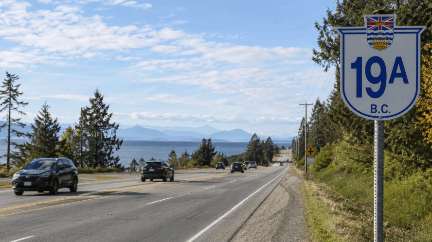
A transportation study of Highway 19A between Oyster River and Jubilee Parkway on Vancouver Island has been completed, giving provincial and regional officials a new planning framework for potential safety, mobility and active transportation investments along the corridor.
The British Columbia Ministry of Transportation and Transit completed the study with support from the Strathcona Regional District (SRD). The work, undertaken by Urban Systems Ltd. on behalf of the ministry, examined current transportation conditions and identified opportunities related to road safety, access management and connections for pedestrians and cyclists.
While the study does not commit governments to specific construction projects or timelines, its findings are expected to help guide future planning, funding applications and investment decisions.
Highway 19A Study Focuses on Safety and Connectivity
Highway 19A serves as an important transportation route for communities in the Campbell River area, connecting neighbourhoods with schools, parks, beaches, businesses, transit services and recreational destinations.
The corridor is used by local residents for daily travel and by visitors heading to Oyster River and nearby attractions, making transportation safety and accessibility a concern for multiple levels of government and community organizations.
The planning process included engagement with local First Nations, the Strathcona Regional District, School District 72, BC Transit and other community and agency partners with interests in transportation and access along the route.
The resulting study identified several areas where changes could potentially improve conditions for motorists, pedestrians, cyclists and public transit users.
Active Transportation and Access Improvements Identified
Potential opportunities outlined through the planning work include new or improved active transportation connections, changes to access management, signage enhancements and other measures intended to support safer movement along Highway 19A.
The study also identified locations where additional technical analysis could be needed before governments determine whether specific transportation improvements should proceed.
Such analysis could influence the scope and cost of future projects, as well as decisions about which improvements receive priority when funding becomes available.
For the Strathcona Regional District, completion of the study provides additional information that can be used when working with the province and other partners on transportation infrastructure priorities.
Area D Residents Have Raised Highway Safety Concerns
John Rice, director for Electoral Area D at the Strathcona Regional District, said improving conditions along the highway has been a longstanding local priority.
“Improving safety along Highway 19A has been a longstanding priority for Area D residents,” said John Rice, Director for Electoral Area D, Strathcona Regional District. “I want to thank the Ministry for responding to local concerns and undertaking this important work, as well as the many partners and interest holders who contributed their time and perspectives throughout the process. This corridor provides access to neighbourhoods, schools, beaches, parks, and transit services that are important to both residents and visitors. The study gives us a clearer understanding of the challenges and opportunities along the corridor and provides a strong foundation for future improvements.”
The study’s completion does not mean all of the identified opportunities will move immediately to construction. Some proposals could require further engineering and technical work, design development, additional consultation and funding before implementation is considered.
Study Could Support Future Infrastructure Funding Decisions
Transportation planning studies can play an important role in establishing priorities before governments commit capital funding. In this case, the findings provide the Ministry of Transportation and Transit, the SRD and other partners with a framework for evaluating possible future investments along the Oyster River corridor.
The work could also support future funding applications by providing documented information about existing transportation conditions and potential improvements.
Among the broader objectives are improving accessibility and connectivity while expanding options for active transportation. Measures benefiting pedestrians and cyclists could complement improvements aimed at motorists and transit users, particularly where Highway 19A provides access to schools, parks and community destinations.
No Construction Timeline Announced for Highway 19A Improvements
No construction schedule, project budget or specific funding commitment was announced with the completion of the study.
Instead, the planning work represents an early-stage assessment intended to establish a clearer understanding of transportation needs and potential solutions. Any individual project emerging from the findings could be subject to separate technical reviews, approvals, consultation and funding decisions.
The study itself has not been publicly posted and is not currently available online. The SRD has directed residents seeking additional information about the findings to contact the British Columbia Ministry of Transportation and Transit.
For communities along Highway 19A, the completed assessment provides a foundation for future discussions about infrastructure investment while identifying practical opportunities to make travel through the Oyster River corridor safer and more accessible.
Discover more from Wire Service Canada
Subscribe to get the latest posts sent to your email.